

Same’s citadel on the hills of Kyatis – Agioi Fanentes and Palaiokastro – Arx Major.
Same’s citadel on the hills of Kyatis – Agioi Fanentes and Palaiokastro – Arx Major.
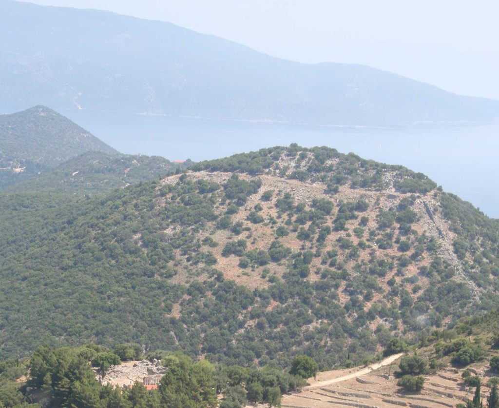
Same’s citadel from east/NE: the hill of Palaiokastro – Arx Major and the hill of Kyatis – Agioi Fanentes above Same’s bay in the background.
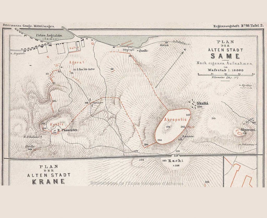
A topographic map of the acropolis of Same was made by the English geographer J. Partsch (Partsch, J. Franz Maria, Kephallenia und Ithaka:EinegeographischeMonographie, Gotha, 1890)
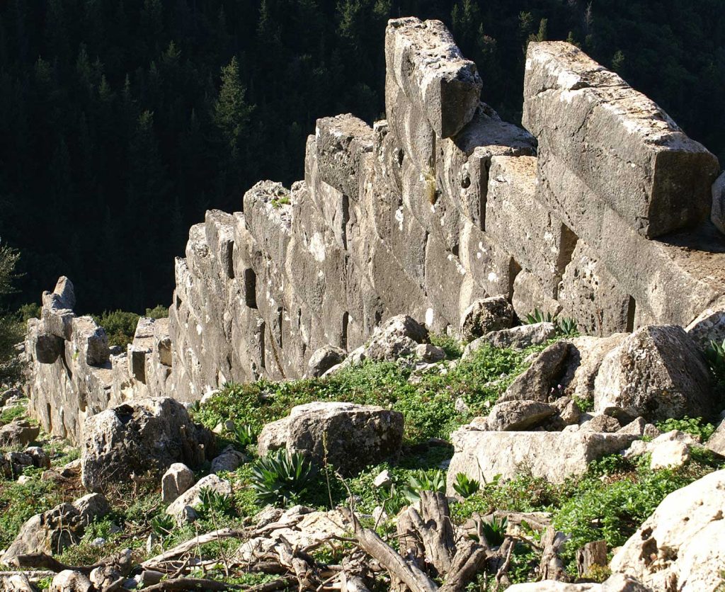
The fortification wall running down the south slope of the “Paliokastro” or “ΑrxΜajor” hill.
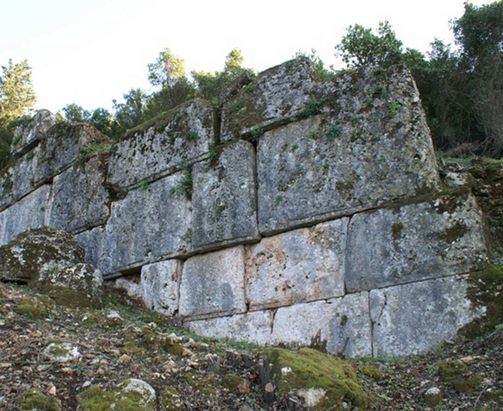
Part of wall’s north part, built between the years 375-350 BC.
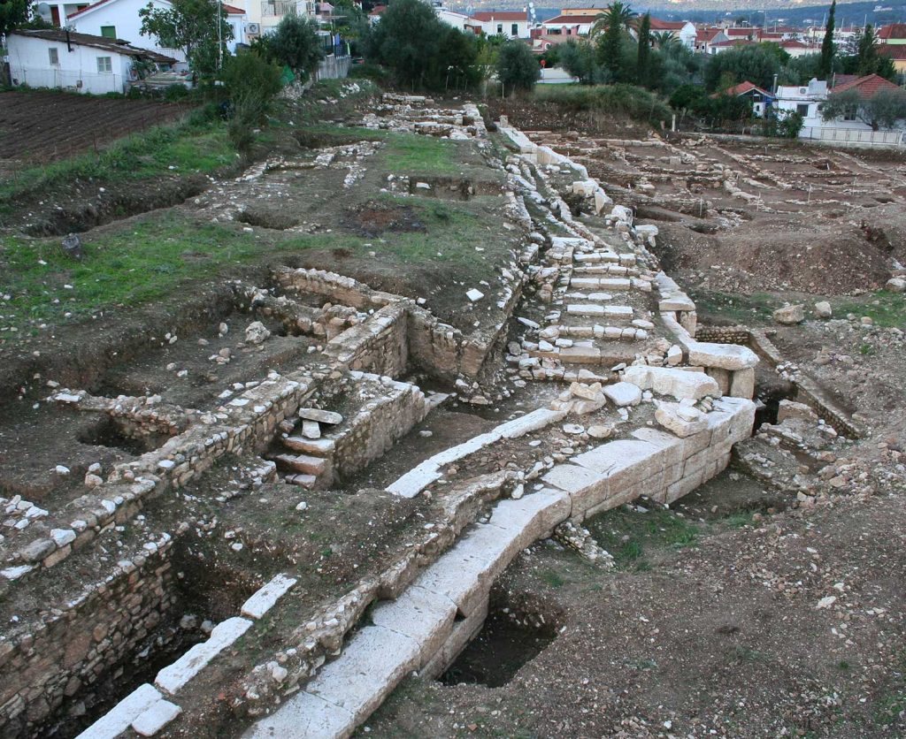
Part of Same’s coastal wall on Navarinou Str., at the NE edge of the city. The wall was extended to the west, to the sea side in the end of the 4th cent. BC, thus connecting the northern and the southern parts of the fortification.
The fortification wall running down the south slope of the “Paliokastro” or “ΑrxΜajor” hill and the monastery of Ag. Fanentes depicted in the background.
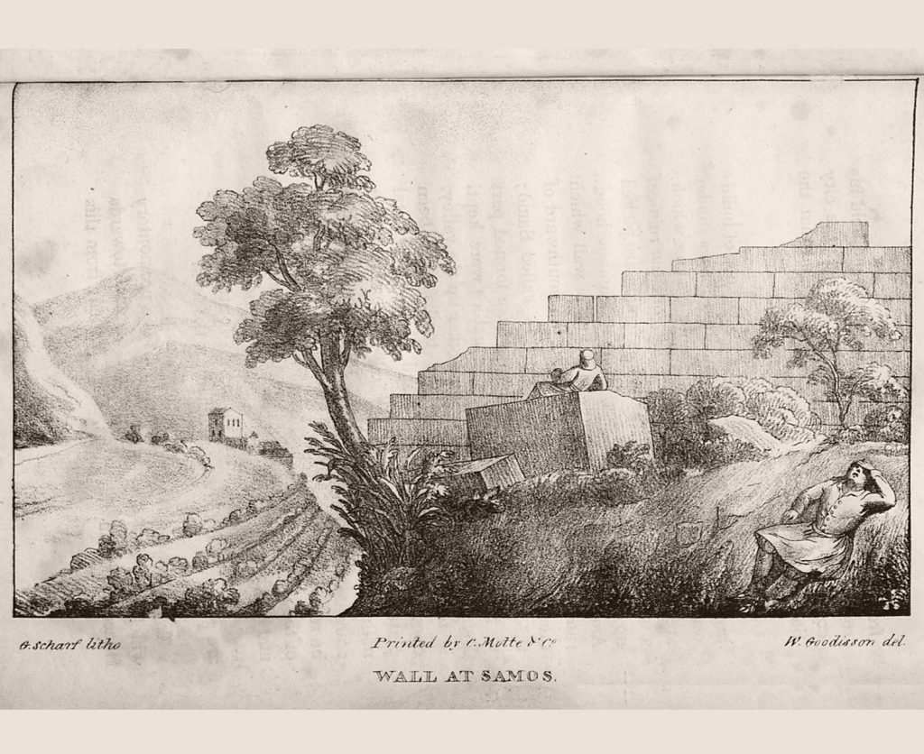
Goodisson W. A historical and topographical Εssay upon the Islands of Corfou, Leucadia, Cephalonia, Ithaca, and Zante: with Remarks upon the Character, Manners, and Customs of the Ionian Greeks; Descriptions of the Scenery and Remains of Antiquity discovered therein, and Reflections upon the Cyclopean Ruins. Illustrated by Maps and Sketches, London 1822, 152.
Same’s classical city, following the model of other Greek city-sates of those times, had a strong fortification wall, which reflects the need to protect the citizens from external threats in the Classical and Hellenistic periods. Same’s enemies could even include the other cities of Cephalonia from times to times.
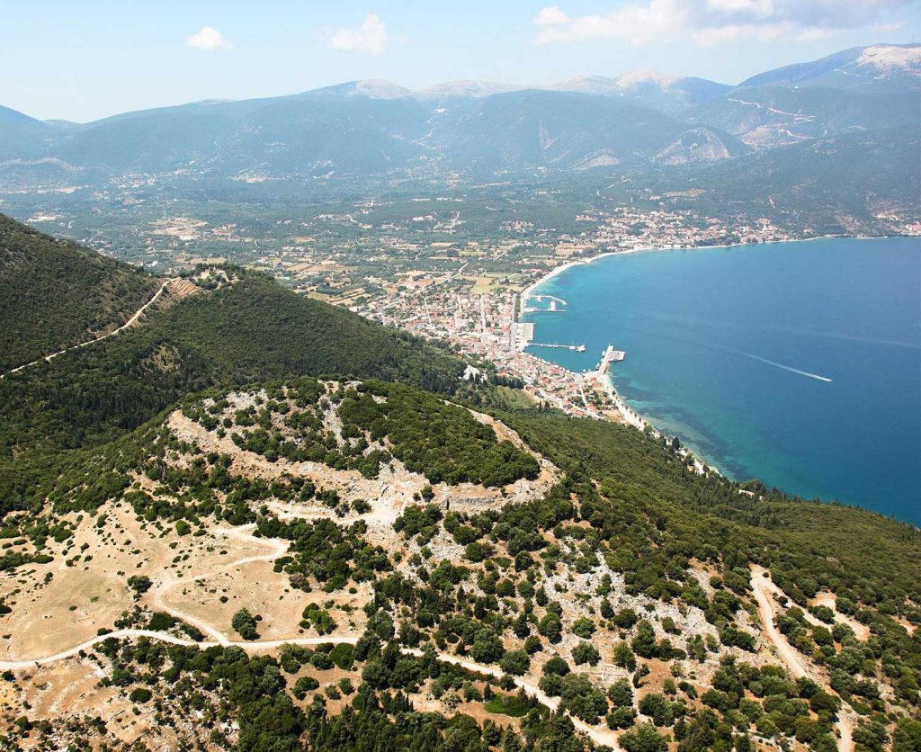
The citadel rises on the hills of “arxmajor” or “Paliokastro” (as mentioned by Livius when describing Same’ siege by the Romans) and Kyatis or “Agioi Fanentes”, east/northeast of the modern town, with a deep valley in between the two hills. The fortification was supported by a tower, cross walls on the two hills’ slopes and a coastal part for the city’s protection on the sea side. The citadel was entered through five gates. Better preserved is the so-called eastern gate of the great citadel. The fortification was a great technical project, which appears to have started in the 5th cent. BC, and then altered with later extensions and repairs, as reflected in the various different building systems, as well as in later interventions that took place over the centuries until even the Medieval times, when major historical events took place and respective influences reached the city from centers of power controlling the Greek cities’ fortunes in those times. The ancient city’s fortification was completed at around 300 BC., when the coastal wall was constructed in order to protect from the sea side. The local limestone was used as building material for time-, effort- and money-saving purposes. The extent and form of the fortification was apparently dictated by the city’s population and the ground formation at those points which secured the best natural support of the walls.
One of the clearest interventions to the citadel is the Agioi Fanentes monastery that was constructed inside the Kyatis citadel. Parts of the ancient walls were immured in the monastery’s peribolos wall, which looked like a fort.